

Ustyurt Plateau
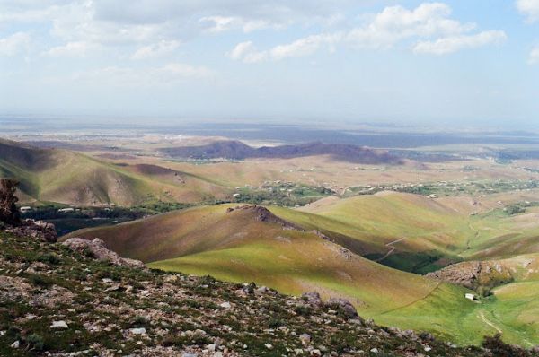
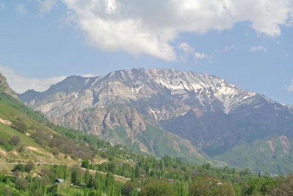
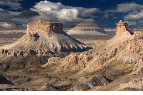
The Ustyurt Plateau is an ancient geological formation with an area of more than 200,000 square kilometers located on the territory of Uzbekistan, Kazakhstan and Turkmenistan. The Ustyurt plateau itself is a huge flat semi–desert, but its borders are hundred-meter cliffs, walls of limestone and chalk layers that have been compacted for millions of years at the bottom of the ancient sea. Today, these cliffs have acquired an unusual shape under the influence of water, wind and time.
The Ustyurt plateau in Uzbekistan is a long line of cliffs running from north to south and bordering the Aral Sea, and the cliffs themselves are called the term "chink". Ustyurt in Kazakhstan consists of entire tracts with cliffs and even remnant mountains nearby, which have acquired complex shapes due to the stronger influence of erosion. Turkmenistan has a small southern part of the Ustyurt plateau, which is a mixture of tracts and straight sections of the plateau walls. At the same time, Ustyurt in Turkmenistan is located in the border area, therefore it is practically inaccessible to tourists.
In this guide, we will talk about the Ustyurt plateau in Uzbekistan and provide useful links to its sites in Kazakhstan.
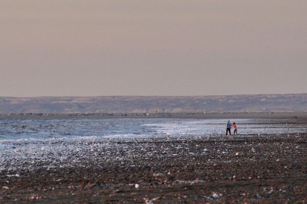
The journey to the Ustyurt plateau in Uzbekistan starts from Nukus. There is an international airport in this city, and here you can also find jeeps with drivers who know the region. A trip to the Ustyurt plateau is usually part of a tour to the Aral Sea. After leaving Nukus, tourists first visit Muinak and the ship cemetery, drive along the former seabed to the plateau, and then stop for the night in a yurt camp on one of its ledges. You can go back by a slightly different road and see another part of the Ustyurt plateau – an acute cape near the abandoned village of Urga, which towers over Lake Sudochye.
You can visit the Ustyurt plateau in just one day, but then you will need to leave Nukus before dawn. It is much better to set aside two days for the tour in order to spend the night in a yurt and watch the sunrise over the Aral Sea. And if you add another day and take a few extra cans of gasoline, you can take a trip along the Ustyurt plateau to the north to find steeper cliffs and cliffs.
The age of the Ustyurt plateau is unknown for sure and, according to scientists, ranges from 20 to 60 million years. However, the Ustyurt plateau was definitely part of the ancient Tethys Ocean, and later part of the ancient Sarmatian and Akchagalyk seas. Today, teeth of prehistoric sharks can be found in many corners of Ustyurt, where new fresh cliffs expose the ancient rock.
In the history of mankind, the Ustyurt plateau has always been an uninhabitable space, but already in the sixth and third millennia, primitive people who belong to the Celteminar culture (sedentary fishermen of the Neolithic era) lived very close by, off the shores of the Aral Sea. During the heyday of the Great Silk Road, Ustyurt was considered a dangerous lifeless place – a huge desert without landmarks, without springs and wells for hundreds of kilometers. Usually, caravans bypassed the Ustyurt plateau from the south, along the Uzbek riverbed, or went north along the Aral Sea. Today, two monuments of those times have been preserved in Uzbekistan – the ruins of the Kurgancha-Kala fortress and the foundation of the lighthouse at Cape Urga.
The first permanent highway crossing the Ustyurt plateau appeared in the middle of the 20th century, and the Kungrad-Beineu railway was built only in 1972. The plateau today does not represent any economic significance, but the tourism industry is developing and its most picturesque places are gaining popularity among tourists - these are the chinks of Ustyurt on the Aral Sea in Uzbekistan and the tracts in Mangistau in Kazakhstan.