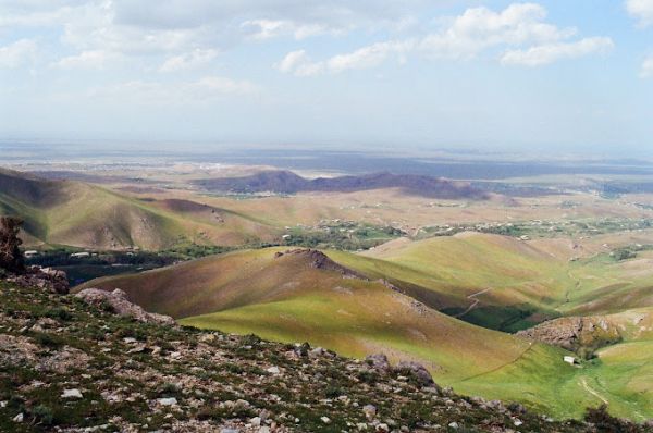


The Aral Sea
Surprisingly, according to the calculations of scientists, the age of the Aral Sea is only 17.6 thousand years. By geological standards, this is an instant. Apparently, when the last ice Age ended, the glaciers of the Tien Shan and Pamir began to melt, and streams of water rushed along the Syr Darya and Amu Darya rivers. Scientists have determined that the process of filling the basin of the future Aral Sea took more than 2,000 years, but even then the lake did not reach its maximum. Periodically, the Amu Darya River changed its course, and therefore the water flowed into the Aral Sea, then into the Caspian Sea.
Fluctuations in the level of the Aral Sea have occurred even over the past thousand years. Back in the XV century it was a group of large lakes, and at the end of the XVI century the Aral Sea reached its maximum, but already in the XVII century the water level fell, and the islands of Barsakelmes, Vozrozhdenie, Kokaral and others were formed.
The history of the Aral Sea in the history of mankind begins in the IV-III millennia BC. In those distant times, Neolithic tribes settled on the shores of the Aral Sea and in the Amu Darya Delta. They were engaged in fishing and hunting, and lived in large communal houses that could accommodate up to 100 people. Anthropologists call this settlement of ancient people the Celteminar culture.
Gradually, people mastered agriculture and irrigation. Already in the 7th century BC, the chronicles mention the state of Khorezm, which grew up on the shores of the Amu Darya, south of the Aral Sea. There were no permanent settlements in the northern part of the Aral Sea yet, and nomadic tribes lived there, periodically raiding Khorezm, which built fortresses for protection.
In the 1st century AD, the Aral Sea was known in the Roman Empire as Lake Oxy, after the name of the Oks River (Amu Darya). In the 10th century, the Arabs who conquered Central Asia called it the Khorezm Sea. There were also names Gurganj Sea and Cheese.
In 2001, the Kerderi mausoleum was discovered at the bottom of the Aral Sea, in its northern part near the former island of Barsakelmes, and then another mausoleum and a settlement named Aral-Asar. The Kerderi Mausoleum dates back to the 12th century, and burials in it belong to Islamic culture with elements of shamanism and Tengrianism. And the last burials were made here in the 14th century. For centuries, the mausoleum and other archaeological finds have been hidden under water, at a depth of 20 meters. Today they are located on the territory of Kazakhstan.
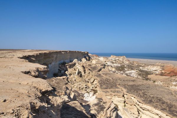
Also, in the XII-XIII centuries, the Kurgancha-Kala fortress was built on the western coast of the Aral Sea, on the ledges of the Ustyurt plateau. It is assumed that it was the northernmost outpost of Khorezm, and also served as a caravanserai where merchants of the Great Silk Road stopped. Today, this fortress can be viewed on a tour of the Aral Sea.
The name of the Aral Sea appeared at the end of the 17th century. In the Turkic language, it sounded like Aral-Tengiz and meant "sea of islands" or "island sea": Aral – "island", tengiz – "sea". It is assumed that this is due to the large number of islands in the Amu Darya delta at that time.
In 1717, the Russian army led by Prince Alexander Bekovich-Cherkassky marched to Khiva through the Ustyurt plateau and along the Aral Sea. In 1847, Fort Raim was built in the northeastern part of the Aral Sea, and today its ruins are located in Kazakhstan. In 1849, the Russians conducted the first scientific expedition to the Aral Sea. For this purpose, the schooner Konstantin was built, which was delivered disassembled to the northern coast of the Aral Sea. The expedition was led by A. Butakov, and the artist was T. Shevchenko, a famous Ukrainian writer and poet. They made a map of the coastline, measured the depths, carried out meteorological and astronomical observations, and other scientific work. In 1850, a map of the Aral Sea was published in Russia.
In 1852, the steamships Perovsky and Obruchev were brought to Fort Raim on camels in disassembled form. And in 1853 they were assembled and launched. They were engaged in coastal protection on the Aral Sea and upstream of the Syr Darya. Then other steamships were delivered, and merchant and fishing vessels were built on site. Scientific expeditions were conducted and trade routes were established. In 1905, Russian merchants created the Khiva joint-stock company in the city of Aralsk (Kazakhstan) and launched fishing on an industrial scale.
During the Soviet era, all fishing artels were nationalized, and the scale of fish production grew every year. The fishermen's nets included such species as Aral salmon, barbel, bream, carp, roach, walleye and others. In the best years, 50,000 tons of fish were caught in the Aral Sea. In the 1950s, the village of Muynak became a fishing center in the southern Aral Sea, and in 1963 it received the status of a city.
The exact date of the beginning of the ecological disaster in the Aral Sea is unknown, but for the first time a sharp drop in water levels was recorded in 1961. This is primarily due to the growing water needs of agriculture, as well as the construction of the Karakum Canal on the Amu Darya – the first part of the canal was opened in 1959. In 1962, when the canal was completed, it began to take 45% of all water from the Amu Darya.
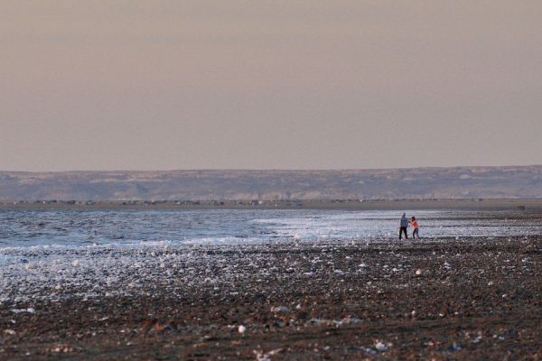
In 1960, the water level was 53.4 meters, and the area of the Aral Sea was 68.9 thousand square kilometers. By 1980, the water level had dropped by 7 meters to 46.4 meters, and the area had shrunk to 51.7 thousand square kilometers. In 1990, there were already figures of 38.2 meters and an area of 36.8 thousand square kilometers. There is no exact data for 2024, but the water level is approximately 28 meters, and the area is only 7 thousand square kilometers. The water level dropped by 26 meters, and the area was reduced by 10 times!
By the end of the 1980s, the fish factories in the cities of Muinak and Aralsk were closed, and the ships were permanently moored in the ports. Today, the skeletons of these boats can be seen at the ship cemetery in Muynak.
In 2003-2005, the Kokaral Dam, 13 km long, was built in Kazakhstan to preserve the northern part of the Aral Sea, which today is called the Small Aral. Thanks to this project, it was possible to restore the water level to 42 meters. The salinity of the water gradually decreased, and fish reappeared here, and the ecosystem began to recover.
In 2008, gas deposits were discovered on the dried-up bottom of the Aral Sea in Uzbekistan, and today its active production is underway there. The Aralkum desert has formed in place of the sea, with its ecosystem, which they are trying to improve by planting saxaul and other desert plant species.
Someday the Aral Sea will become full-flowing again, but, unfortunately, this will not happen in our century.